


GEOGRAPHY
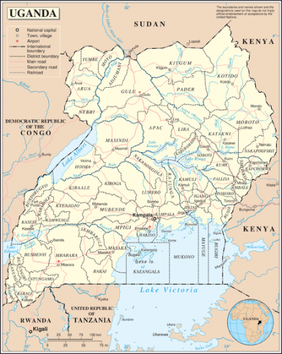
Uganda is a landlocked country bordered by Kenya in the east, Sudan in the north, Democratic Republic of the Congo in the west, Rwanda in the southwest and Tanzania in the south.
The total land area is 241,559 sq km. About 37,000 sq km of this area is occupied by open water while the rest is land. The southern part of the country includes a substantial portion of Lake Victoria, which it shares with Kenya and Tanzania.
Uganda is located on the East African plateau, averaging about 1,100 meters (3,609 ft) above sea level. The plateau generally slopes downwards towards Sudan explaining the northerly tendency of most river flows in the country. Although generally equatorial, the climate is not uniform since the altitude modifies the climate.
The elevation, soil types and predominantly warm and wet climate impart a huge agricultural potential to the country. They also explain the large variety of forests, grasslands and wildlife reserves. Uganda has a total population of about 32 million people.
AREA
Land Area: 199,808 Sq. Km.
Water and Swamps: 41,743 Sq. Km
Total Area: 241,551 Sq. Km.
LOCATION
Latitude: 4012 N and 1029 S
Longitude:29034 E and 3500 W
ALTITUDE
Minimum (above sea level Albert Nile): 620 metres
Maximum (above sea level Mt. Rwenzori):5,110 metres
CLIMATE
Kampala: Annual Mean Temperature: 17.00C
Kampala: Annual Rainfall: 1436.0 mm
LAND USE
Arable Land: 25%
Permanent Crops: 9%
Permanent Pastures:9%
Forests and Woodland: 28%
Other: 29%